24790616-diaporama
24870911-diaporama
Also known as the Chemin du Milieu, this ethnobotanical trail takes you through the forest of Piégut. An educational booklet can be borrowed from the tourist office to follow in the footsteps of Jacques the woodcutter!
À propos : Sentier du Bucheron – Hiking from Auris-en-Oisans resort
TECHNICAL INFORMATION:
Start: Place des Orgières
Height difference: 123 m
Loop duration: 1 h 30
Distance: 3.2 km
MAP AND TOPO
IGN Top 25 Bourg d'Oisans and Alpe d'Huez 3335 ETµ
Topo guide OBP n°3 (on sale at the tourist office): path 347 towards Plancet
ITINERARY :
Starting at the end of the camping car park, you enter the Piégut forest, heading towards the Combe Fréry. Halfway along, at the intersection, take the left-hand path up to the resort.
TO SEE ON THE WAY
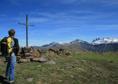
- Piégut forest
- Discovery trail on the life of the forest
NEARBY
- Plancet picnic area
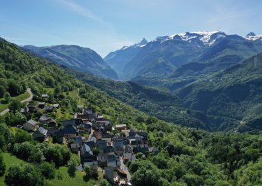
- Hamlet of Certs
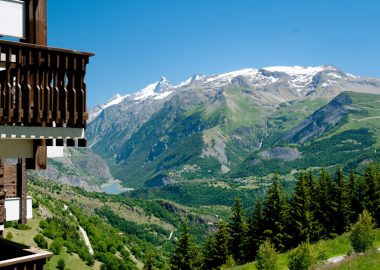
- Auris-en-Oisans resort and hamlets
En bref
1 h 30
D+ : 123 m
3.2 km
Level green – easy
Plan et tracé GPX
Sentier du Bucheron – Hiking from Auris-en-Oisans resort
Auris-en-Oisans
Équipements
- Car park
Services
- Pets welcome
Prestations
Activités
- Durée séance : 90 minutes
Visites
- Durée moyenne de la individuelle : 90 minutes
Ouverture
From 15/05 to 31/10 daily.
Subject to favorable snow and weather conditions.
Tarifs
Free access.
Accueil animaux
Dogs must be kept on a leash.
Ce prestataire vous propose aussi